Use our interactive tools to search if your home or business is located in a drinking water protection area (also known as a wellfield or wellhead protection area).
Businesses in drinking water protection areas which handle chemicals or disposed of hazardous materials are required by law to implement certain measures to prevent groundwater contamination. Homeowners can also take steps to keep our drinking water safe.
Any business in a wellfield in Marion County is eligible for free assistance by a qualified environmental professional. Contact us to schedule your free Wellfield Review.
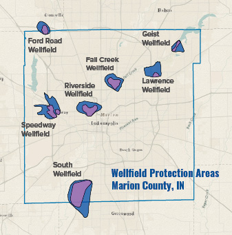
Interactive Wellfield Maps – Indianapolis Area
Please be patient while the map is loading. Below the map are the wellfield PDFs or you can find proximity to wellfields outside of Indianapolis.
Disclaimer: Your use of this map and information provided in this application constitutes your understanding and acceptance of the following conditions: 1) The information provided on this site is for convenience only and is compiled from public records and data. Extensive efforts have been made to offer the most current, correct, and clearly expressed information possible; however, inadvertent errors can occur, and information presented in this map is not intended to replace any official source. Contact the appropriate official information sources for verification of the information provided on this map. 2) Use of any of this information is at the user’s own risk. The Marion County Wellfield Education Corporation (MCWEC) does not assume any legal responsibility for the information contained herin, which is provided “as is” with no warranties of any kind. MCWEC disclaims all liability of any kind arising out of the use of, or misuse of this information and disclaims all express or implied warranties, including warranties of merchantability, fitness for a particular purpose, and non-infringement of proprietary rights. By using this map, I agree that MCWEC will not be liable for any actions, claims, damages or judgments of any nature whatsoever arising out of the use or misuse of the information contained in this map.
PDF Wellfield Maps – Indianapolis Area
Fall Creek Wellfield
Ford Road Wellfield
Lawrence Wellfield
Geist Wellfield
South Wellfield
Speedway Wellfield
Riverside Wellfield
Interactive Wellhead Map – All Indiana
If you are located outside of Marion County, but are interested in checking whether where you live or work is inside another wellfield, check out the Indiana Department of Environmental Management’s Wellhead Proximity Determinator.
Wellfield Signs
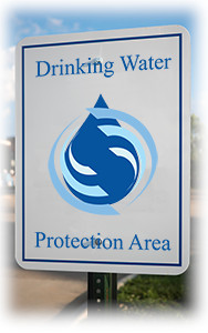
These signs are posted on streets or around the boundaries of the Marion County wellfields.
See a damaged sign? Help us by reporting it.
Still Unsure?
Contact Mundell & Associates and we will check for you!
Phone: (317) 630-9060
Email: info[at]mcwec.org