On November 30, 2023, the U.S. Environmental Protection Agency (EPA) announced a new rule which contains significant advancements in protecting children and adults from the significant, and irreversible, health effects from being exposed to lead in drinking water. The rule is titled Lead and Copper Rule Improvements (LCRI) and focuses on public community water systems with provisions for lowering the lead action level, improving tap sampling, locating lead pipes and achieving 100% replacement within the next 10 years.
This rule is part of a comprehensive strategy of the Biden-Harris Administration’s Lead Pipe and Paint Action Plan. As a part of this plan, resources are available to provide the technical assistance needed for communities to take the important step of creating a inventory of lead service lines, which are required to be in use by October 2024. One important technical piece of taking action on lead service lines is implementation of Geographic Information System (GIS) tools.
Using GIS tools to put the location of known lead service lines on a map is one very important step, but advances in GIS software and the growing GIS profession take data management, field work and public outreach to a new level when it comes to protecting our communities from lead in drinking water.
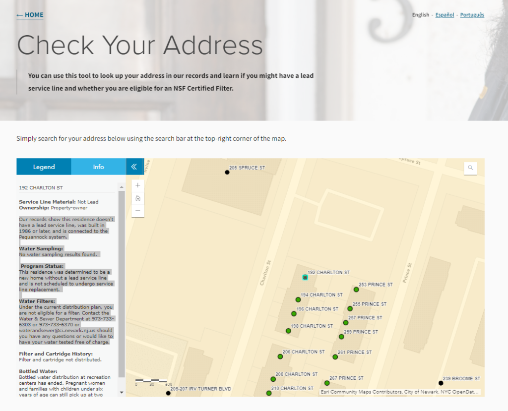
In the city of Newark, New Jersey, the Lead Service Line Replacement Program created an online GIS tool for residents to look up their address and learn if they might have a lead service line. The tool provides other important information such as when lead service lines are scheduled to undergo replacement, how to request water sampling, and if the home might eligible for an NSF Certified Water Filter.

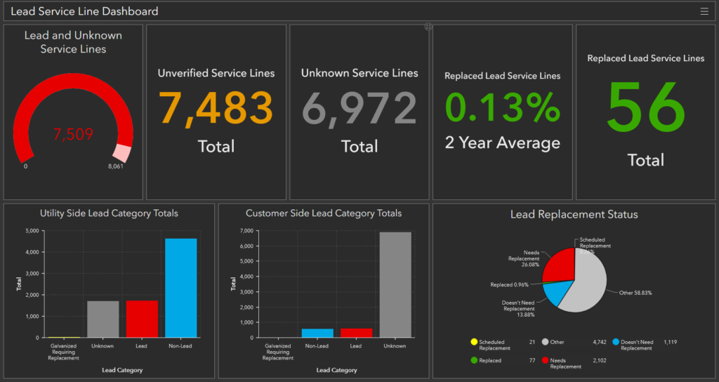
In Pennsylvania, the Greater Johnstown Water Authority implemented a turn-key lead service line inventory solution and realized the benefits of consolidating their data in numerous ways. Having service line data available in the field has improved work with both internal staff and outside contractors digging near its service lines being easily able to identify pipe materials and size from online maps. To manage the progress to a lead-free community, the water utility uses a dashboard to know at a glance how many lead service line locations have be verified and replaced.

These are but a few examples. Across the country, water utilities are using GIS to plan, implement, and communicate information about lead service lines so that no one need worry about lead exposure from drinking water.
To know more about lead service lines in your area, check with your local utility. If you are a community needing technical assistance, help is available through the EPA’s FREE WaterTA program – https://www.epa.gov/water-infrastructure/water-technical-assistance-waterta.
Note: This is Part 2 in a 3-part series on how GIS can be used to protect drinking water. Read Part 1 (Planning for Lead Service Line Replacements) and Part 3 (Protecting Drinking Water in the Global Community).
