• Skip to main content
  • Skip to footer

MCWEC

Groundwater and Drinking Water Protection for Indianapolis and Marion County Indiana

  •  
  • FAQ
    • Am I in a Wellfield?
    • Wellfield FAQs
    • Who is MCWEC?
  • For Businesses
    • Industry Specific Guidelines
    • Local Regulations
    • Guides, Forms, & Resources
  • Free Assessments
  • Waste Disposal
  • Reports
  • News
  • Contact
  • Spanish
You are here: Home / News / New Water Cycle Diagram from the USGS

New Water Cycle Diagram from the USGS

February 17, 2023

Spanish

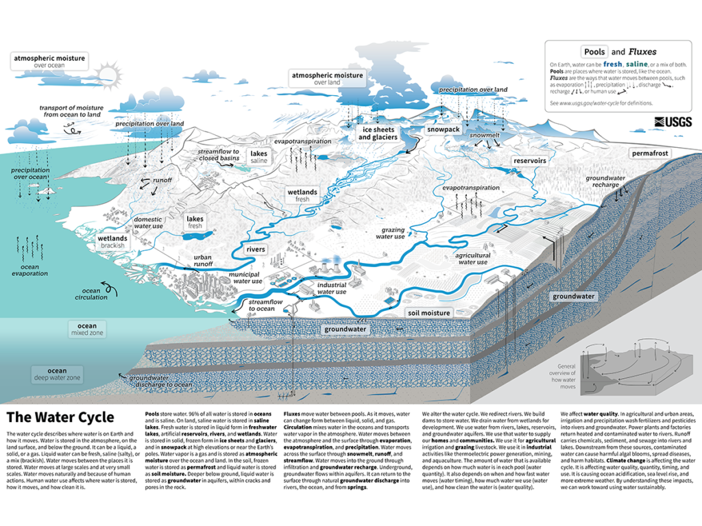
The U.S. Geological Survey (USGS) recently released a new water cycle diagram which depicts the global water cycle.

In addition to being available in English and Spanish, more language translations are planned. The new diagram clearly explains how water is stored, how it moves, and how humans impact water quality and flow.

Teachers can also download a “fillable” PDF to test students knowledge. Check it out!

Who is the U.S. Geological Survey?

The USGS is the sole science agency for the Department of the Interior. It is sought out by thousands of partners and customers for its natural science expertise and its vast earth and biological data holdings. 

Footer

Free, Confidential Assessments

MCWEC representatives can help your business identify site specific ways to limit potential for groundwater contamination. You may receive free spill containment supplies in return. These assessments are free and intended to ensure businesses are operating in ways protective to groundwater; observations are NOT reported to any regulatory agencies.

Schedule Your Assessment

About the Marion County Wellfield Corporation

In My Community

Get connected with the water in your community!
The U.S. EPA offers a variety of tools to discover the environment around you.

© 2023 · Marion County Wellfield Education Corporation · Privacy Policy · Terms of Use · Contact