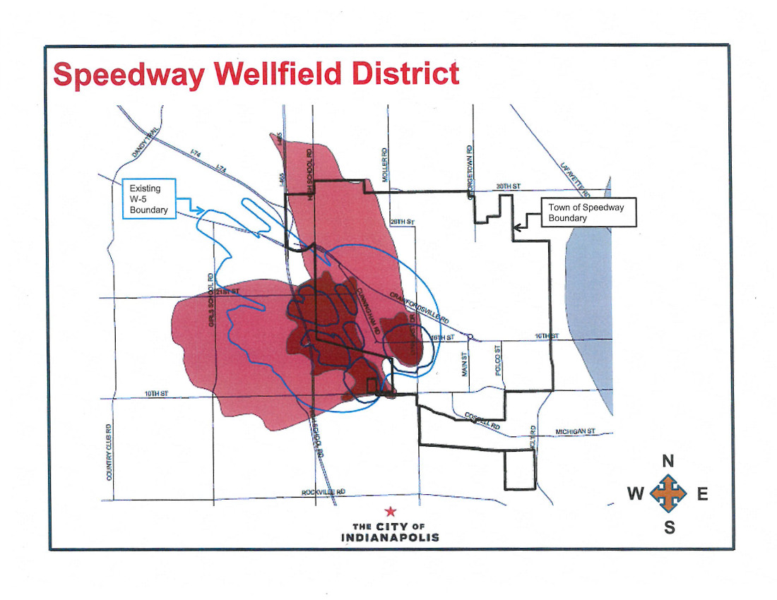
Recently, a scientific study was conducted that changed the shape and boundaries of the wellfield protection areas for the Speedway wellfield. This means that the some new areas have entered wellfield protection areas and others are no longer a part of wellfield protection areas.
If your business is new to the Speedway wellfield protection area, you should have received a letter last week letting you know what wellfield protection area you are a part of and giving you information about MCWEC.
How can I learn more?
An informal walk-in meeting will be held on November 16, 2016 from 5:30 to 7 at the Speedway Town Hall (located at 1450 North Lynhurst Drive) where experts will be available to answer your questions. Alternatively, you may contact us if you have any questions about what this means for you or what you need to do.
What are the new boundaries?

Why did the boundaries change?
Land within the wellfields are divided into two sections, land whose groundwater is within a 1-year travel time to the wellhead (W-1) or land whose groundwater is within a 5-year travel time to the wellhead (W-5). (What is a wellfield? What is a wellhead?) When we talk about the travel time from an area of land to the wellhead that is a way to represent how long it would take for a drop of groundwater underneath that property to reach one of the pumping wells that supply drinking water.
At regular intervals, scientific studies are conducted to determine what land is included as a part of a wellfield. Wellfield boundaries can change when pumping wells are added or removed from the wellfields, as more accurate scientific data is available about the groundwater in the area, or if groundwater flow changes.
